
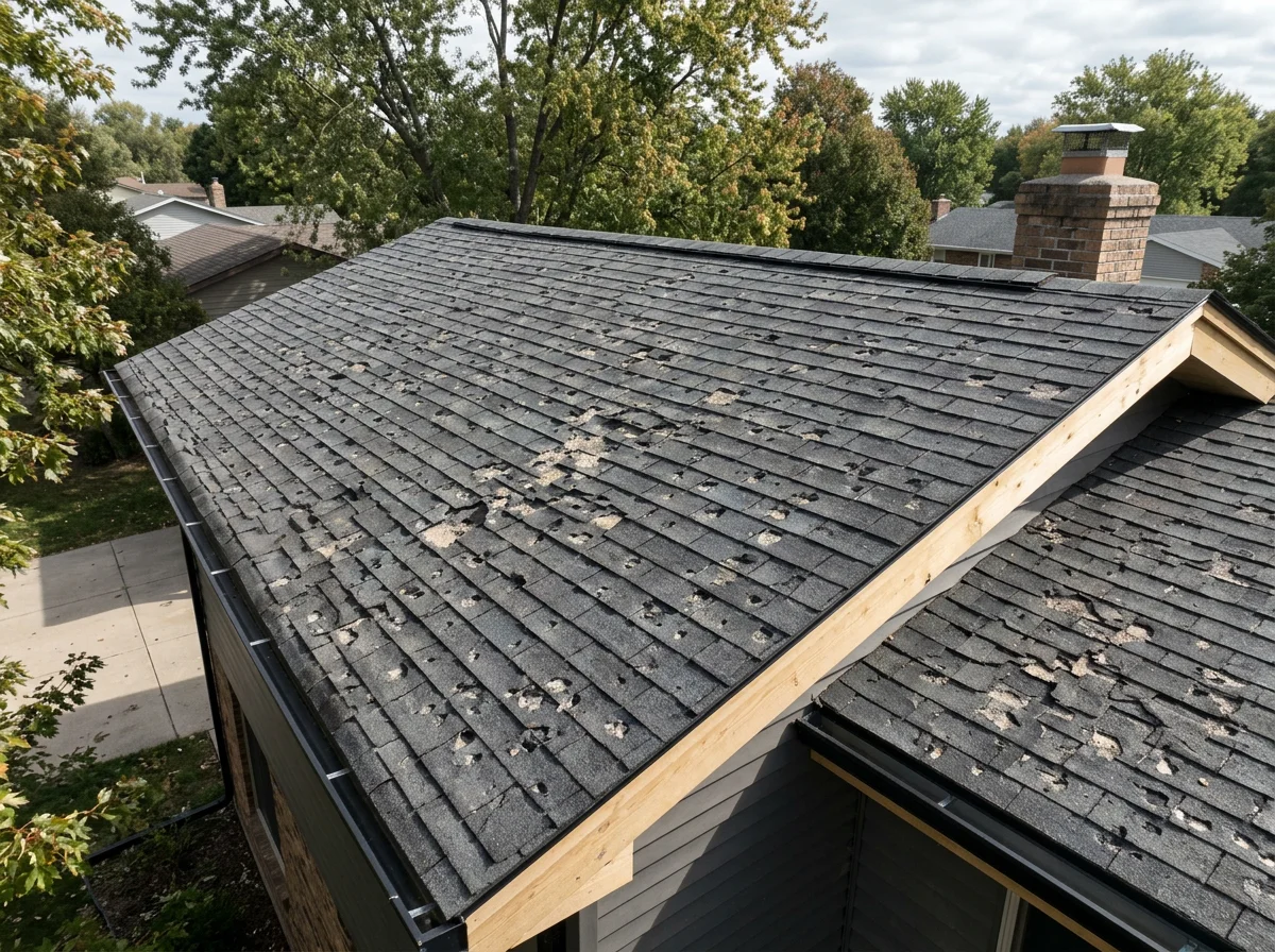
Aerial Drone Inspection Services
Part 107 Certified
Our drone inspection services provide detailed visual assessments of roofs, building exteriors, utilities, and infrastructure. By capturing high-resolution imagery of difficult-to-access areas, we help property owners and maintenance teams document visible conditions, identify potential concerns, and make more informed decisions about further inspection and maintenance.
Buildings and roofs: Document visible damage, wear, and exterior conditions.
Bridges and infrastructure: Inspect visible surfaces, joints, supports, and other accessible structural components.
Wind turbines: Document exterior conditions on tall structures that can be difficult and time-consuming to inspect manually.
Drone Inspection Deliverables
High-Resolution Aerial Photos
1
Roofs, building exteriors, utility structures, bridges, and general condition documentation
Visible cracks, surface wear, corrosion, damaged roofing, and accessible structural details
2
Close-Up Detail Photos
4K Inspection Video
Visual review of building exteriors, rooftops, towers, and other structures
3
Annotated Inspection Images
Highlighting visible concerns, damage locations, or areas requiring further review
4
Repeat Site Documentation
5
Periodic visual records of facilities, roofs, utility corridors, and infrastructure
Scope of Services
Our drone services provide visual documentation of accessible exterior surfaces, structures, and job sites. Deliverables may include high-resolution photographs, video, and annotated photo reports.
Our services are intended to document visible conditions and support maintenance planning. They do not replace professional engineering assessments, certified inspections, or land surveying. We do not currently offer survey-grade measurements, dimensional verification, or certified mapping products.
How It Works
-
Let us know what you need inspected, the location, and any special areas of concern. We’ll help determine the right approach for your project.
-
We’ll coordinate a convenient time, review site conditions and access requirements, and plan the flight around your projects needs.
-
We use professional drone equipment to capture high resolution photos and video of hard to reach areas, helping document visible conditions safely and efficiently.
-
You’ll receive you finished imagery and any agreed upon reports in an organized digital format, ready for review, documentation, and sharing with your team.
Frequently Asked Questions
Can you provide measurements using your drone?
Our current drone equipment is designed primarily for aerial photography and visual documentation. We do not offer survey-grade measurements, certified dimensions, or boundary surveys. If your project requires precise measurements, we can help clarify the type of data you'll need from a qualified surveying or mapping provider.
Can your drone determine whether a structure is damaged?
We can photograph visible signs of wear or potential damage to help document conditions and identify areas that may warrant further evaluation. We do not diagnose structural defects or certify the safety or integrity of buildings, bridges, or other infrastructure.
Do you offer specialized inspections of power lines, bridges, or wind turbines?
Projects involving specialized infrastructure are evaluated individually based on access, flight conditions, safety requirements, and project scope. We confirm capabilities and deliverables before accepting each project.